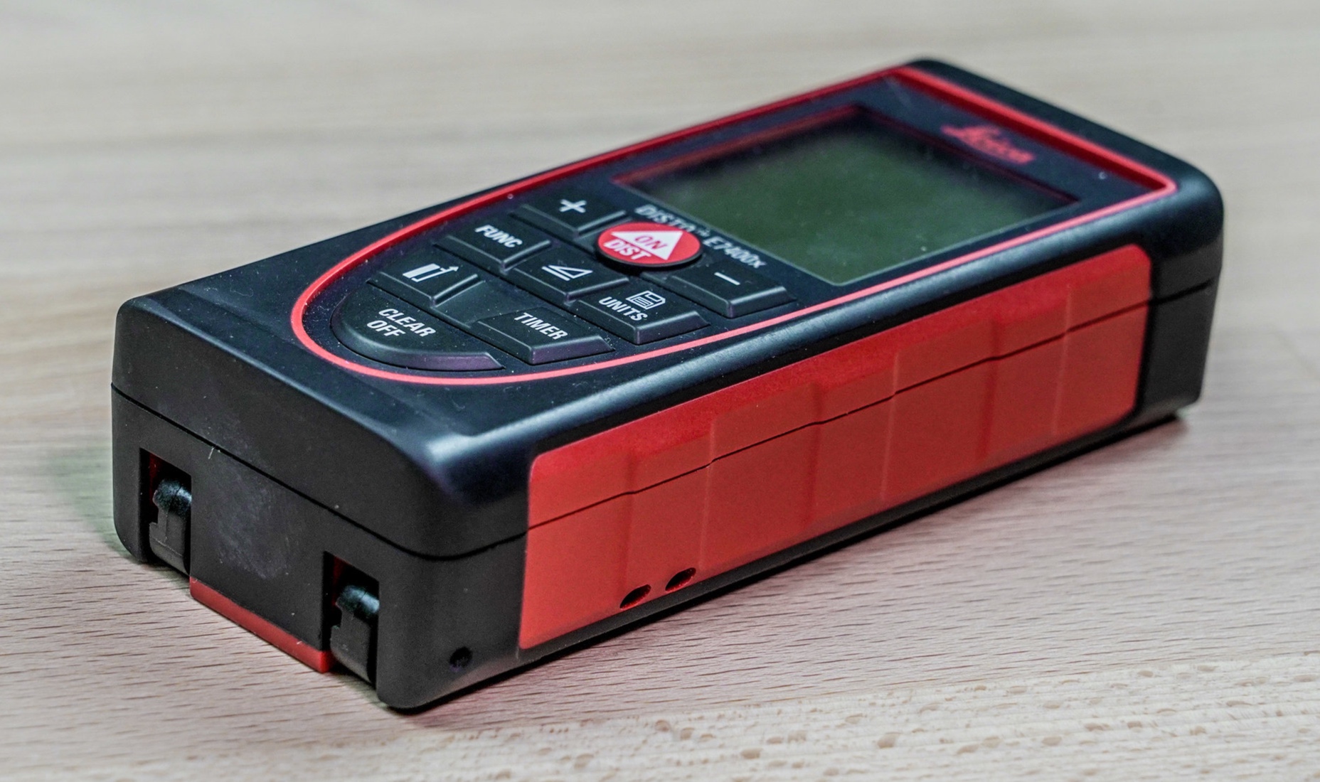
Disto-x2
Beat Heeb developed the original Disto-X in 2008 by designing and building a custom board that could be installed into a Leica Disto A3. The installed board added the ability to measure azimuth and inclination using a built-in digital magnetometer and accelerometer. It wasn’t a trivial task to build one of these custom units, and they required frequent calibration due to the magnetic fields generated by the replaceable batteries. In late 2013 Beat introduced the Disto-X2, which was designed around the newer Disto e7400x (x310 in Europe). This board was significantly easier to install, and the design also utilized an internal rechargeable non-magnetic lithium battery. The resulting Disto-X2 unit is more rugged and waterproof, and easier to calibrate and use. Availability has also improved and these devices are now in widespread use across the globe. Anyone who has used one is reluctant to ever go back to traditional analog survey instruments. The Disto-X2 improves the speed of data collection, lowers the barrier to teaching new cavers how to survey, eliminates or reduces the potential for many types of survey data collection errors, and enables faster and more accurate digital sketching. It has revolutionized cave survey.
Disto-x2 calibration
The 3-axis magnetometer, 3-axis accelerometer and laser inside the Disto-X2 requires calibration in order to adjust the sensor readings to output accurate azimuth and inclination values. Once a calibration has been completed it usually will continue to generate accurate and repeatable measurements for up to two months, but drift in the magnetometer output requires that a new calibration be performed periodically. It’s also wise to perform a new calibration when surveying in a very different geographic region due to changes in the dip of the Earth’s magnetic field. A calibration must be performed using a Bluetooth-paired digital device. There is software that runs on Android, Windows Mobile and Palm devices that will facilitate this calibration.
The calibration process involves collecting 56 measurements, with the Disto-X2 set in a variety of orientations. The raw sensor readings from these measurements are then transferred to a phone, PDA or tablet using Bluetooth. Software on the external device calculates a series of 24 mathematical coefficients which are then uploaded back to the Disto-X2. Some Disto-X2 units have accelerometers that increase the variation in the readings, so it’s possible to add 3 additional “non-linear” coefficients to improve the quality of the calibration.
The following video gives an overview of the calibration process carried out in a cave. The Disto-X2 magnetometers are more sensitive to interference than traditional needle or card compasses, so it’s critical that calibrations be conducted far away from human structures. A cave is the ideal location.
Calibration can be performed using PocketTopo software running on a Windows Mobile device, TopoDroid running on an Android Device, or a dedicated Disto-X calibration program that runs on a Palm OS device.
The following video explains how to use PocketTopo software to perform a calibration.
Disto-X2 Firmware
In the summer of 2019 the latest firmware version for the Disto-X2 is ver. 2.5. Since 2013, when the Disto-X2 was first released, there have been some changes to the components used in/on both the Leica Disto e7400x and the Disto-X2 board. The latest firmware has the necessary drivers for any of the different hardware versions currently in circulation. It also has a few new functions that weren’t available in earlier firmware releases, so every owner of a Disto-X2 should update to ver. 2.5. There are only two device / software combinations that include firmware upgrade capability. Upgrading the firmware is potentially risky and the instructions should be read thoroughly and followed exactly.
The following video is a step-by-stop guide for using PocketTopo software to perform a firmware upgrade. PocketTopo is free software that runs on a Windows Mobile device.
The following video is a tutorial on all of the Disto-X2 functions in TopoDroid, which is free software that runs on Android devices. The tutorial includes instructions on how to perform a firmware upgrade. This video also explains the process for performing a calibration.