Survey efficiency
Cave survey can be a slow and tedious process that may cause trip participants to get cold and bored, but this is usually a consequence of poor planning and preparation, and an inefficient workflow. Survey is frequently accompanied by new discoveries and exploration, and can be some of the most exciting and memorable caving you will ever do. Arriving in the cave with clearly assigned objectives and team roles, and having the survey equipment organized can help to survey and explore more passage, and produce better quality data. The video below contains a few suggestions for improving your cave survey experience.
survey page templates
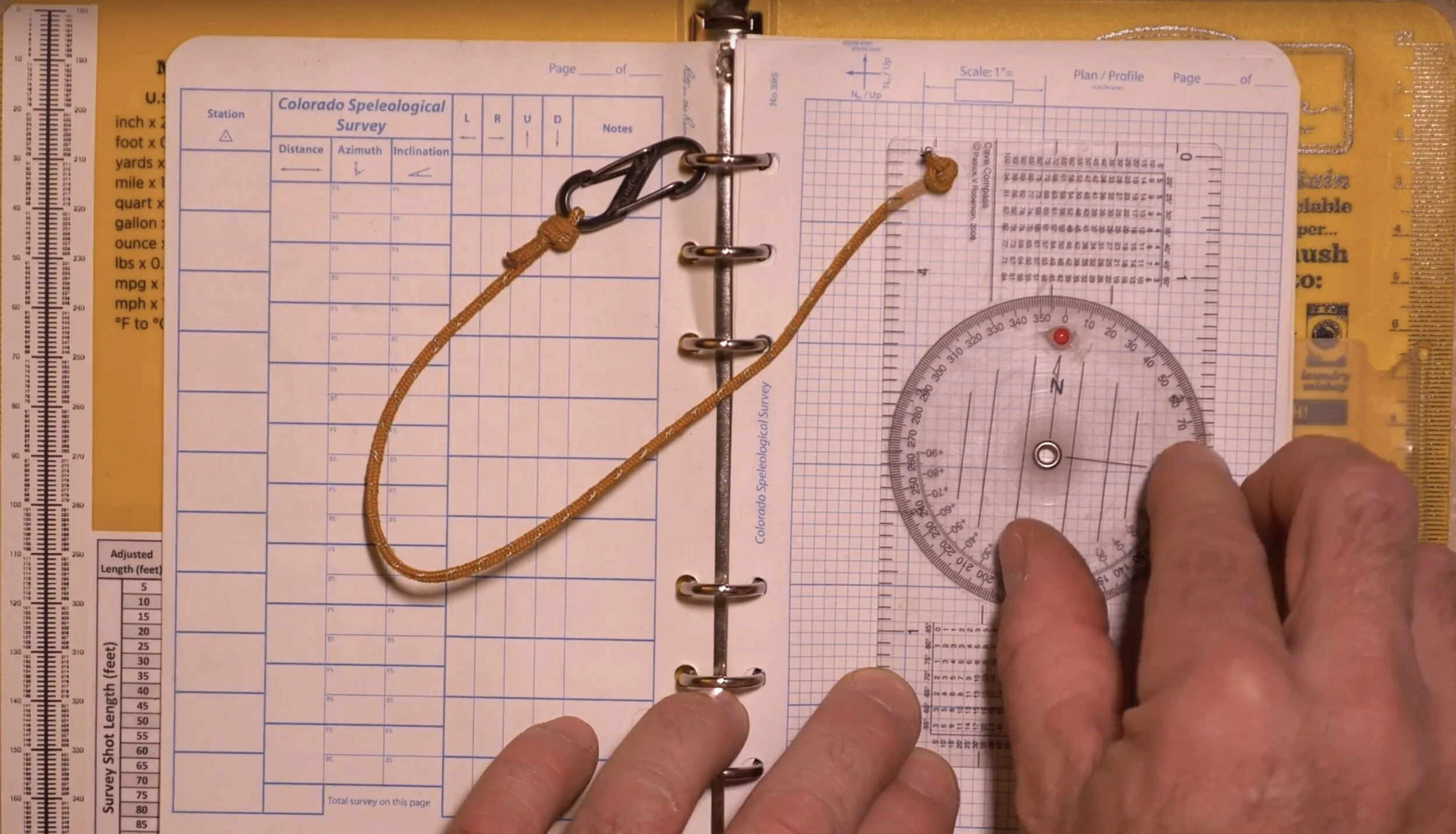
I’ve created a series of templates for title pages, data pages, and graph pages (both imperial and metric) that you can download and use to print your own survey pages. If you don’t want the hassle of printing your own, then you can buy pre-printed survey paper from either OnRope1 or Inner Mountain Outfitters. I recommend printing on blank Rite-in-the-Rain paper in either the 4.6 x 7 inch size (No. 395) or 8.5 x 11 inch size (No. 8511). The light-blue pattern is strongly recommended because it contrasts with pencil graphite. A black grid or printed text makes it very difficult to decipher written notes or sketches. If using these templates to print your own survey pages, please use a color laser printer. The water-based ink used in inkjet printers will dissolve and bleed in the wet or high humidity environment of a cave. The wax based toner used in laser printers does very well in the cave environment. Below are templates in PDF format that can just be printed as-is. If you want to make your own pages and customize them with additional fields, or perhaps add your project’s logo, then I’ve also attached the original Adobe Illustrator versions, which can be edited (CC 2019 version).


PDF Paper template downloads (4 5/8 x 7 inch paper):
illustrator paper template downloads (4 5/8 x 7 inch paper):
PDF paper template downloads (8 1/2 x 11 inch paper):
illustrator paper template downloads (8 1/2 x 11 inch paper):
Survey book references
I print and attach several notes and tables to the inside covers of the plastic Rite-in-the-Rain 6-ring binder. These include a trigonometry table for calculating the shortened plan-view shot length for steep angle survey shots (over 20 degrees). I have imperial (feet) and metric (meters) versions of these tables. I also tape a 0-180 fore sight / back sight conversion scale that can be used for reference when recording uncorrected back sights and there is a need to validate with the front sight. In most cases I do this math in my head, but after 12 hours of sketching the brain can get a little mushy, and having a reference scale can be useful. I also tape a list of Disto-X2 functions into the sketch book. I keep a second copy under the rubber insert in the Pelican 1015 box, but having an extra copy in the book has come in handy. You can download and print these using the links below:


sketch symbol cheat-sheet
If you’re new to sketching then it is often difficult to recall the various symbols used to represent speleoclasts, speleothems, etc. I print a small cheat-sheet that lives in the back of my binder for easy reference. There are many versions of this sheet. Mine is not comprehensive, but covers most of the usual features. If you encounter something atypical, you can always make up your own symbol as long as you add a legend to the sketch, but using the standard symbols recognized by the NSS, MSS or UIS will make it easier for a cartographer to decipher. Two of these sheets will fit on a standard 8.5 x 11 inch page. A double-sided PDF can be downloaded below.

