
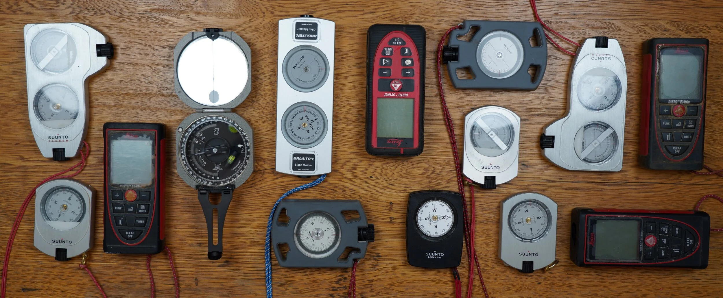
cave survey instruments
Cave surveys require both accuracy and precision. Accuracy is the ability to deliver a measured value that is as close as possible to the true value. Precision relates to how exact and repeatable a measurement can be made. The critical cave survey measurements are the distance, azimuth and inclination between stations. There are only a few instruments that meet the requirements of a cave survey and are also portable and rugged enough to survive the rigors of caving.
measuring distance
For many years cavers used steel tapes to measure distance because they didn’t stretch, but they were prone to rusting and breaking, and they were difficult to manage. These were replaced by fiberglass reinforced measuring tapes, which are cheaper, lighter and easier to clean. Fiberglass tapes in both imperial engineering scales and metric scales are still in widespread use. Some sketchers still favor these over laser rangefinders because the tape can be left on the ground following a measurement, and the line the tape takes and reference lengths along the tape can be used to improve the accuracy of the sketch. These are generally read to the nearest 0.1 feet or 1 cm. Most surveyors have now converted to laser rangefinders like those from Bosch or the Disto brand made by Leica. These have high accuracy and precision, good reliability, and some models have a range that exceeds most measuring tapes. Some other advantages of rangefinders are the ability to take measurements through small holes, avoidance of the need to drag a tape through potentially delicate areas, and the ability to take measurements into alcoves, dead-ends, down pits, and up domes without the need to send a second person out to the end of the measurement.


brunton transit
The standard cave survey instrument from nearly the dawn of cave survey through the 1970s was the Brunton Pocket Transit. This rugged and waterproof instrument has the ability to measure both azimuths and inclinations to a precision of 0.5 degrees. They were almost entirely replaced by sighting compasses/inclinometers by the early 1980s due to the fact that they are relatively expensive, and difficult and time consuming to learn and use.


sighting compasses and inclinometers
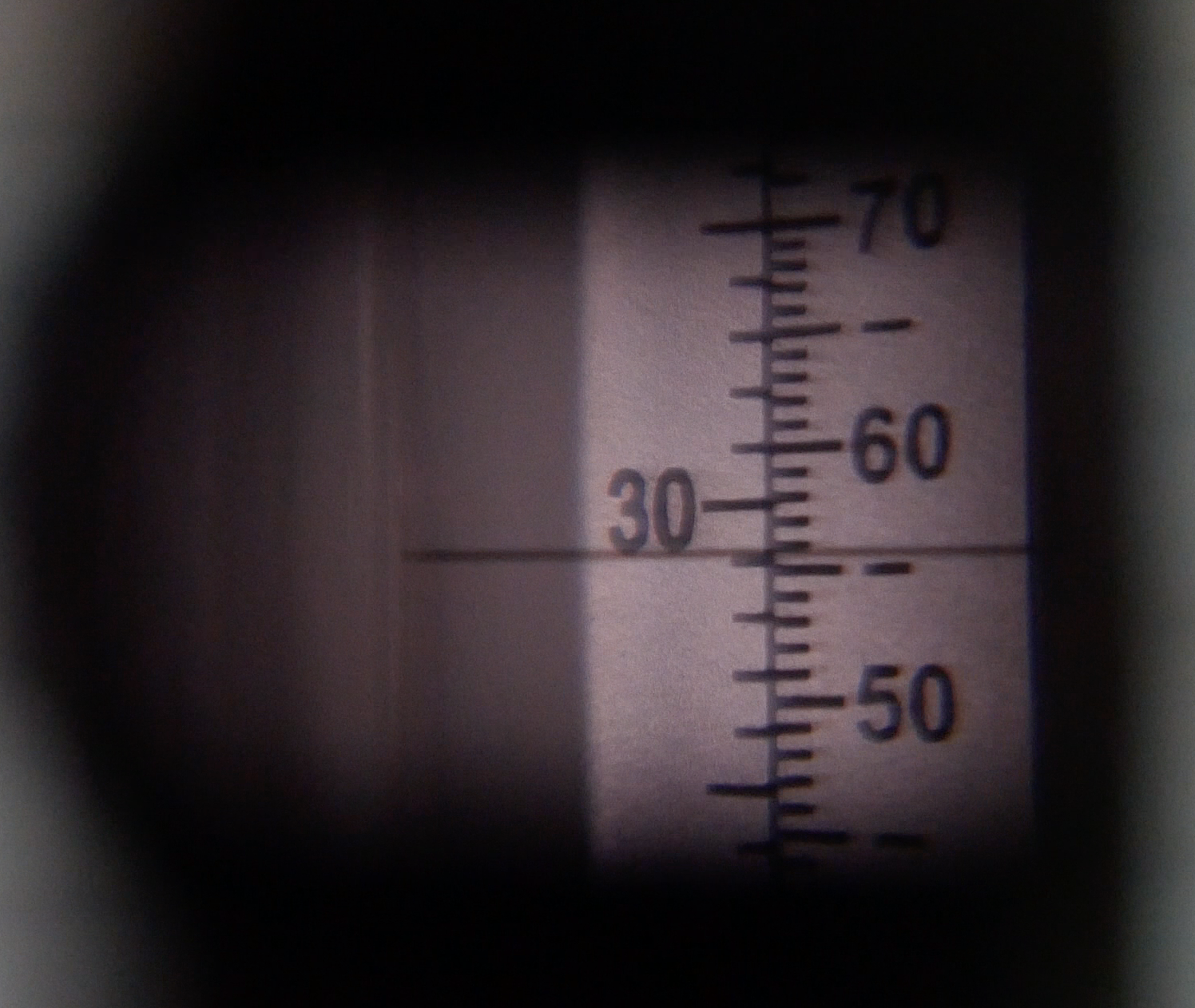
These were introduced originally by Suunto in the 1970s. They have a sealed capsule with a disc that is fluid damped and rides on a sapphire bearing. There is a sighting lens that allows alignment of the instrument with a target and an index line for taking a reading from a scale printed on the edge of the disc. They can be read to a precision of 0.5 degrees.
The original Suunto instruments included a separate compass and inclinometer. Another Finnish company, Sisteco, later produced the Surveymaster that incorporated both instruments in a single aluminum housing. Sisteco and Brunton were both acquired by Silva who continued to make the Surveymaster, but it can be found with any of three different brand labels, most recently by Brunton, but this was recently discontinued. Suunto also now produces a dual instrument called the Tandem. Brunton started making the OmniSight compass and OmniSlope inclinometer in 2015.
Sighting compasses were quickly adopted by cave surveyors because they were less expensive than the Brunton Pocket Transit and they were much easier to train new surveyors to use. The Suunto inclinometer in particular was much easier to read than the Transit.


Digital devices
Electronic survey instruments that utilize digital magnetometers and accelerometers have been available in devices designed for cave survey for about 10 years. Early devices included the Shetland Attack Pony, DUSI and Disto-X. The Disto-X was the only device that included a laser rangefinder in addition to instruments that measured azimuth and inclination, but it was difficult to build and required frequent calibration. Most of these devices are no longer manufactured, but the Disto-X2 became available in late 2013 and has mostly replaced analog survey instruments.

